Chuckwalla Trail
- Alex Cabrero
- Aug 18, 2025
- 4 min read

Updated: Nov 22, 2025

(St. George) Sometimes you don’t hike a trail just for the scenery. Sometimes you hike it because you need space to think, to breathe, and maybe to make some big life decisions. For me, the Chuckwalla Trail in St. George was exactly that. Aspen and I wandered out here on a quiet day and it turned out to be the perfect reset button.
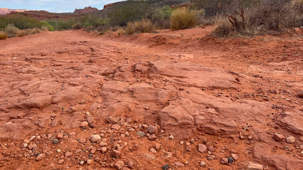
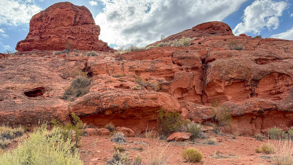
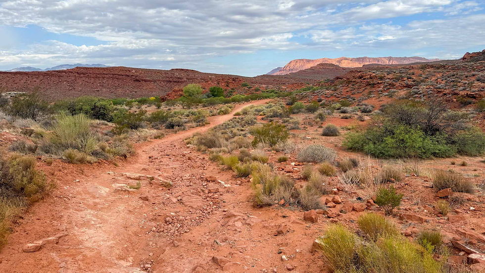
The Chuckwalla Trail is an easy, scenic hike that winds its way through some red rock formations and desert brush. I mapped it at 1.9 miles roundtrip, starting from the trailhead and heading to the end and back. You could do this trail in flip-flops, if you wanted to. But if you do it in the summer, make sure you bring water. It can get very hot out here.

There's a spot toward the end of the trail where you can get under some trees for shade. This is nice if you're hiking in the hot summer sun. I think the trees are cottonwoods. They look old and I can't imagine how many years they have been providing shade for hikers.

The trail is well-marked, wide enough in most spots, and just about anyone could enjoy it. If you like taking pictures, this place is perfect. If you're just starting out as a photographer, I think this is a great place to practice landscape shots. There are shadows, colors, and plenty of rock formations to set your guidelines and horizon shots. It's one of those scenic hikes in St. George where you can't really take a bad picture.

There’s even a trail sign at the end of the Chuckwalla Trail pointing you toward other trails, such as Beck Hill, Turtle Wall, and Paradise Rim... if you’re looking to keep the adventure going. I stuck to Chuckwalla this time, but I took a photo of that trail sign like a good blogger should.

Chuckwalla is a dog-friendly trail (on-leash, officially). And yes, Aspen was leashed when people were around. But when it was just us, I unclipped her for a bit. She has excellent recall, and I think she appreciated the freedom. Watching her bound up the trail like it was made just for her was almost as healing as the hike itself.

Along the way, Aspen and I saw rock climbers scaling sandstone walls, a few birds overhead, and plenty of those iconic St. George red rocks glowing in the sun. Even though most people hike this trail, mountain bikers use it, too. Chuckwalla leads to several other trails I think mountain bikers would love.
Along the way, you'll hike in spots where you can see water has eroded the sand and created a little gully. Kind of a mini Grand Canyon... or, at least you can understand how the Grand Canyon was created over bajillions of years of water eroding the rock and sand. Here at the Chuckwalla, it's just a neat little feature to ponder.

What made this hike special for me wasn’t just the beauty, though it has plenty of that. It came at a time when I was weighing some big job and life decisions. My brain was noisy, but this trail helped quiet it down. Something about the way the sunlight hits those cliffs, the stillness of the desert air, and the sound of Aspen's paws crunching the sand gave me the peace and clarity I needed. I only saw four other people here on the day I hiked Chuckwalla. It's funny in a way... you think you’re out hiking for exercise, but sometimes the best hikes aren't the toughest ones. They're the ones that meet you exactly where you are.

The Chuckwalla Trail isn't the longest trail, the it was enough to give me exactly what I needed: a peaceful couple of miles to clear my head. Aspen wagged her tail the whole way, which tells me she approved too.

If you’re in St. George and need a trail that combines scenic red rock, an easy path, and maybe a bit of unexpected perspective, this is the one.

Length: ~1.9 miles roundtrip (just Chuckwalla itself).
Difficulty: Easy, family- and dog-friendly.
Wildlife: Birds, rabbits, maybe a desert tortoise if you’re lucky. Gila monsters are said to roam these parts too, so keep an eye out but don’t expect them to pose for selfies the way Aspen does.
Extras: If you want to extend the hike, check out Turtle Wall or Paradise Rim from the end of the trail.

TRAILHEAD LOCATION
From St. George, head north on Bluff Street. Keep right towards Enterprise and continue straight as the road turns into Hwy 18. In 0.1 miles, immediately take the first left turn onto Country Road and park at the trailhead.
37.138278, -113.604722

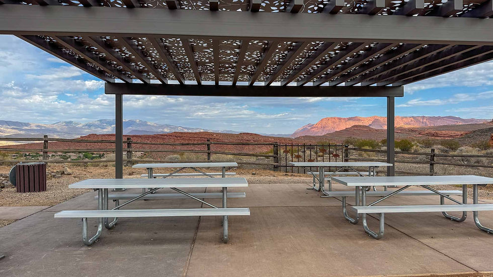
There are also toilets at the trailhead parking lot and picnic tables under a covered gazebo.


Comments