Big Springs Hollow
- Alex Cabrero
- Sep 15, 2025
- 5 min read

Updated: Nov 22, 2025

(Provo Canyon) Sometimes, you just need to get out and breathe. Know what I mean? The kind of breathe that only happens when you’re halfway up a trail, heart pounding, legs burning, and wondering why you thought this was a good idea. Then you look around, see the view and the mountains, and remember exactly why. That's how I felt while hiking the Big Springs Hollow Loop Trail near Provo Canyon.

You’ll find the trailhead at Big Springs Park, which is just up South Fork Road above Vivian Park in Provo Canyon. From there, it’s easy to see why this place is very popular during the warmer months. There are plenty of picnic tables, shade, families grilling burgers, and kids chasing frisbees. Lots of laughter, too. Drive all the way to the parking lot (you can't go any further), and the trailhead and sign are right there near the last pavilion.

My excited puppy Aspen and I did a 2.6-mile loop by following the map on the AllTrails app. The loop is basically a mash-up of the Big Springs Hollow, South Fork Packard Canyon, Shingle Mill, and Grassy Field Cruise trails (and probably a few other side paths because I have a knack for “creative navigation”). The AllTrails app has you going counterclockwise, but naturally, I went clockwise. Still fun. Still uphill.
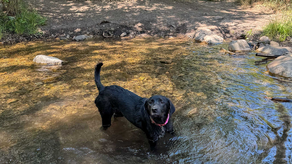
The trail starts easy by a little pond. Aspen immediately found the little stream and treated it like her personal water fountain. I’m glad she did, because it gave me time to enjoy the cool air and smell of the trees. The beginning of this hike (if you go clockwise) starts in a forest. I have always felt hiking in trees is good for the soul.

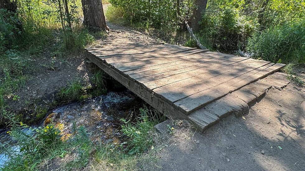
Along this portion of the trail, the path stays close to the creek. You cross a few small wooden bridges. These are great places to let your dog get a drink and to just stop and listen to the sound of the creek. There are also a few places where people have made campfire rings along the creek. I noticed one couple having a picnic with some camp chairs and sandwiches.
After a while, the trail opens into a meadow that gently slopes uphill. There are still trees on both sides of you, but you're out in the open here. There were two clear paths, but I stuck with the one suggested on my AllTrails app. One path looked more like a double track dirt road, the other more of a single track. I stayed on the single track to the right.

Eventually, there is a small trail that veers to the right. Instead of continuing up the meadow, I took this small trail (again, following the AllTrails app) and kept going. This brought you into another beautiful meadow where it felt like you had the place all to yourself. The other hikers I saw stayed on the main trail, but this turn took me away from everyone. I felt like I was going the wrong way because the trail is very narrow with tall grass on each side.

At the end of this narrow trail, you connect with the Great Western Trail. I wouldn't have known that if not for the trail sign. You only stay on this section for a little bit before turning again on a spur that leads you up a ridge. For me, this was the toughest part of the trail. The “gentle slope” we had been following stopped being gentle, and I found myself in a full-on uphill workout. Aspen looked back at me as if to say, “You good, old man?”

I stopped a couple of times going up. Aspen also wanted some water, so we took a break to get water out of my backpack. It was good to be in trees again for some shade. Trust me, though, that climb is worth every step. The view from the top stretches out over the valley. You can see rolling green hills framed by mountain peaks and sky. I stopped there for a while to appreciate the beauty. But also to catch my breath again :)

Sometimes, a good trail reminds you what’s important. After losing Timber a year ago, I wasn’t sure I’d ever have another trail buddy like her. Watching Aspen lead the way with her wagging tail high, ears bouncing, and pure joy, I realized she is that dog. Different from Timber, but perfect in her own way. It made me smile, even as my heart pounded from the climb.

On the way down, there are several different trails you can take. Some of them are shortcuts that put you back on the trail you left. After that hike uphill, it was a relief to go downhill. There are a few different trail signs letting you know what trails are there if you go a certain way. It would be nice to come back one day and do them all.


Next, you come to a gate that brings you into a wide open grassy meadow. It's the kind that makes you feel like you're in the middle of "The Sound of Music" movie because it's surrounded by mountains. I think this must be the “Grassy Field Cruise” section AllTrails mentioned. I had to take a 360-degree video here because it's the kind of view you show your out-of-state friends.
Eventually, we wound our way back toward Big Springs Park. The sounds of laughter and smell of sizzling burgers returned, reminding me how quickly peace can turn back into civilization. But that’s what I love about this trail because you can find both in one loop.

If you’re looking for a short, scenic hike with variety like forest, meadow, stream, and mountain views, Big Springs Hollow delivers. It’s dog-friendly, easy to follow with a map, and a great workout without being too extreme.

Personally, for me, this was more than just another trail. I was thinking about a possible job change, trying to clear my head and listen to what felt right. Somewhere between the stream crossings and the ridge mountain views, things got quieter in my mind. Clarity has a funny way of showing up when your heart is racing and your dog is grinning at you from a few steps ahead. This trail will always be special to me for that reason.

If you go, bring water, take your time, and enjoy the silence between your steps. There are a lot of hikes in Provo Canyon you can do, but this is one you won't regret. It's one of those places that reminds you of how lucky we are to be alive and to get to experience beautiful nature. Of course, it always helps to have a trail dog leading the way :)
LOCATION:
Google Maps link to Big Springs Hollow Trailhead


Comments